My friend Julia tried to kill me tonight.
It was awesome.
She had the bright idea of going out to the Fanshawe Lake conservation area, where there is a ~20 km bike path around the lake. Including the biking to Fanshawe Lake and back, that was a 36 km trip for us — nearly double my last furthest ride! I figured what the hell though, I needed to get off my butt and get in better shape, the weather was awesome for it, and it sounded perfectly lovely: after all, London has a great paved trail system along the river in town. I was expecting much the same around the lake.
I was wrong.
It turned out to be The Cycle Path of Death, Awesomeness, Darkness, and Fireflies.
First off, we had a plan to leave around 6pm so we could do our trek and get home before dark (or, at worst, back to the lit city streets before dark). Unfortunately, I have to accept all the blame there as I didn’t get out of work until 6pm, and then had to have a bite to eat, change, mix up some gatorade, find my bug spray, pump up my tires… and we didn’t leave until nearly 7pm. Still, anticipating a leisurely cruise around the lake, that should have been plenty of time.
We get to the toll gate for the conservation area and find out we have to pay to get in ($5.50 per bike). I didn’t do my research and wasn’t prepared for this, but thankfully Julia spotted me. The cashier manning the gate knew nothing about the park — she had never been on the trail itself, couldn’t tell us if it was paved or gravel or what. She just gave us a map, offered to sell us a season’s pass ($77), and sent us on our merry way. Now, I’m going to be quite critical of the path through here, but we did have a lot of fun, and I think it was worth paying admission for (at least once) — but what are they doing with that money? The signage needs serious improvement in there. If I go back, I’ll be very tempted to go in with a bottle of spray paint and re-mark the damned trail myself.
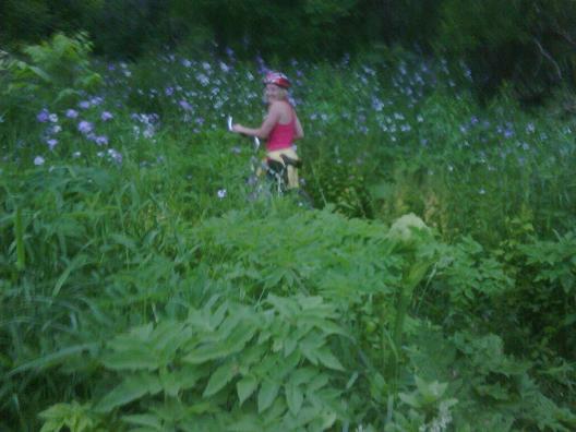
So, she sends us on our merry way, and notes that today is an even day, so cyclists have to do the trail clockwise. We bike off down this nice paved two-lane road (shared by cars and bikes) and think that that was an awful strange, OCD requirement. When we do finally find the bike trail (which, BTW, involved biking around a barrier put across the entrance, presumably to keep cars out, but with no signage) we see why: it is very much a single-file bike trail. Most of the trail is just dirt and mud, with no effort made to clear out the mini-boulders and large tree roots that block the way. It was tough slogging. In some parts, the foliage was so thick and grabby that we felt like we should have been chased by a smoke monster (the passing trains in the middle distance did add the appropriate sound effects though).

There were many parts where we just had to get off the bikes and “portage” – either because of super-steep hills, or big rocks/branches/roots blocking the way. Lots of mud, too.
Perhaps needless to say, but I feel the need to say it anyway: our timeline was fucked. This was a much slower (and harder!) slog through 20 km than we had planned for. Around the 6 or 7 km mark, we ran into two guys who were turning around because they didn’t think they could make it to the end before dark. That was at 8:25 pm. At that point, it had taken nearly an hour for us to get in the first ~6 km, but we figured we still had an hour and a half of light, and that somewhere along the way (soon, we had hoped) the trail incorporated some paved sections where we could burn through the miles. We made the call to keep going around. This was also because we wanted to finish this course, and did not want to return to work the next day with the stench of failure and turning-around-in-the-face-of-darkness on us.
We were quite mad, you see.
The trail continued on, and got progressively worse (hillier, rockier, darker). The darkness was not so much due to the setting sun — which at 8:30 was still decently above the horizon, but because the damned foliage just got so thick the light couldn’t get in! I was having visions of Mirkwood from LotR (and indeed, was attacked by a spider and either a different kind of spider, or a tick). We knew from the map (and my Blackberry’s GPS) that we had to meet the road soon, but the damned trail ended at a small creek, and I didn’t know we were supposed to cross it (there was “black diamond” trail turn-off right around there too, so I thought that’s what the crossing at the creek was). So we had a little detour there down an even denser, less-well cleared path that dead-ended at the lake.
Finally, we hit the road and put on some speed. In no time we covered a good 6 km of the distance. We decided to skip over one section of the path. That part followed the water, and would have been a shorter distance, but definitely would have taken us longer. We got back on the path with a good ~5 km left to go, the sun had definitely set, and it was getting twilighty and dark out (about 9:15pm). It wasn’t bad on the road at all to see, though some giant black moths had come out to attack us on our journey. We discussed sticking to the country roads and taking the long way back home, going by the airport, but figured we could still see and it wasn’t that much further, so we got back into the woods.
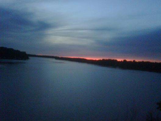
These were the thickest damned woods yet, at least overhead (the path itself wasn’t too bad). It was dark in there. Even though it kept getting later as we rode through there, it was much brighter when we finally broke out of the woods. Here’s a shot of the sunset at one small break in the trees at about the 4 km point.

It was kind of surreal biking through this narrow, hazardous path through the woods at nearly-nighttime. The fireflies were out and blinking at us. At first they were on the border of the path, looking to guide us along. Then one or two flashed at me from deeper in the brush, and I nearly turned to follow them (nearly). There were only a few smatterings of fireflies though — Julia was surprised there weren’t more, figuring that they probably come into prominence later in July. I was glad to see any; they’re a neat thing to see, and I haven’t seen any for years now. If they are in abundance out there later in the summer, I may have to plan another late bike ride through there (with flashlights though!).
As it got darker, we got slower, which just made it get darker. Here’s a picture I took with about 3 km to go. After this, I wasn’t allowed to stop and take any more pictures.

So we’re picking our way through the boulders and tree roots, up hills and down hills all in the rather dark (it wasn’t completely dark, and I claimed that “we did manage to finish before it was dark!” when we got out and there was still a tiny bit of twilight left, but it was pretty damned dark in the woods). As it gets noticeably darker, I start to think about these recurring nightmares I had as a child about running through a supernaturally dark forest while being chased by wolves. I didn’t say anything out loud though, and Julia picks just that moment to ask:
“Hey, do you know what I heard lives around here?”
“The next word out of your mouth had better not be bloody wolves.”
“No, a puma actually.”
“Oh, that’s much better.”
I had turned my safety lights on around the time we were on the road. These, for the record, are not flashlights. They are weak-ass little LEDs that aren’t focused so that cars in front of me can see me approach. And it was getting dark enough for them to actually kinda work as flashlights.
Finally, the trees start thinning out, and it gets a little lighter, then we’re on a completely unmarked gravel road. We take it, since we can’t see another option (it’s possible the bike path branched there to continue along the water a little further before meeting the road again later, but if it did, we couldn’t see it!). The orange glow of sodium lamps starts peeking through the trees, and we can see the dam, our starting point not too far ahead. We made it!
From there, it was a breezy ride back along the city streets at night.
In the end, it was a lot of fun, but there was definitely a lot of adrenaline pumping as we tried to beat the darkness on our way back. Especially since the path was not as novice-rider friendly as we had hoped. Someone could have easily been hurt out there, and after we passed the two guys who chose to turn around, we were the only ones out there.
Oh, it ended up taking us about an hour and a half to finish the course, so turning around would have definitely been the faster option. But we can now say that we did it (and to be fair to me, if the path wasn’t so closed-in, there would have been plenty of light in the time we had remaining there; also, if it was better marked, we could have easily saved 15-30 minutes.
So, to sum up: this is not a path for novice cyclists. It is not a path for road bikes. I can’t recommend starting out at 7pm or later (adjust for the length of the day — in mid-June here sunset’s about as late as it’s going to get). The path is not well-marked, and the Blackberry GPS is so handy!
On the topic of the Blackberry GPS, it’s not a true GPS. For some reason Bell wants a subscription fee to activate the antenna in the device to passively receive the signal from the GPS satellites and determine my location. That’s BS. It also doesn’t have maps stored in it (though with an 8 GB SD card, I should be able to devote ~1 GB to maps of NorthAm at least). What it does, AFAIK, is the handy-dandy Google Maps app will triangulate on the cell towers the phone can pick up on and determine location that way. It’s not as accurate as GPS, and requires a signal (presumably from more than one tower), but it works as well as I need it to. I do also, of course, need a signal to load the map, since the maps aren’t stored locally. So I’m not going to use it in the complete boonies, but how often am I completely without a signal?


 Questrade: use QPass 356624159378948
 Passiv is a tool that can connect to your Questrade account and make it easier to track and rebalance your portfolio, including the ability to make one-click trades.